Unit 25: second location shoot
More photography for Unit 25. Today, I spent a number of hours out at various locations in Lancashire.
I started in earnest at Goosnargh outside a Vet's practice. Why? Well, because part of the grounds contains the former 'Regional Government Headquarters' in the event of a nuclear war. The bunker buildings are there - pictures can be seen here. But, in the end, I got cold feet. I didn't fancy walking in and also felt rather insecure about asking permission. Perhaps some other time?
The other thing is that I felt it was moving away from the focus of my project again. Although there's a relationship - I think there was/is a lot of sense in the argument that nuclear power and the resultant waste leads to nuclear proliferation - it may be taking the project off in another direction.
Not too put off, I headed off to Inskip, the site of a disused airbase considered by Nirex for disposal of waste. It stands out from a distance because of the proliferation of radio masts, but when you draw near, there are all kinds of warnings signs about trespass and the fact that it is still MOD land. To be honest, I missed opportunities to take some shots from the car - lots of lovely dilapidated barracks and Nissen huts. Instead, I shot viewpoints from a road junction.
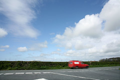
I felt that there was something symbolic in the 'Give Way' signs - an instruction, or an invitation?
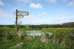
I may return and try something else out at a later date.
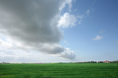
Then it was westwards to Weeton, the site of an army barracks, and another site considered for the disposal of nuclear waste. There was no stopping here - lots of gateways with 'NO PARKING - MOD' etc. Looking back, I could have briefly stopped and shot them, but these things often occur to me afterwards. Instead, I parked up in a laybay on a bend and shot a broad view of the landscape, taking in the South side of the camp and beyond. Blackpool Tower was clearly in view, although my 24mm lens has minimised it somewhat.
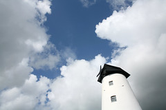
After this, I travelled on to what was the final stop - Springfields, a nuclear fuel fabrication plant. This place already stores waste above ground. It also apparently makes depleted uranium. I knew from the map that there was a windmill right next door, but upon arriving, it was clear that it was now a pub. The sails had been shorn, which was a delicious irony.
I then got back in the car and drove around the western end of the site. This felt like a very compact and enclosed place, almost 'secret'. I headed back and took some shots outside the main entrance:
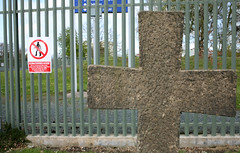
A stone cross, on the verge near the entrance. Rich in symbolism - how bizarre.
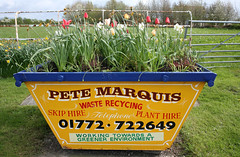
But even more delicious is the 'floral skip' on the other side of the road!
The text that adorns it is fantastic. It's sometimes amazing how these things can exist and deliver such subconscious ironies?
I called it a day without visiting two other sites. But there should be a re-visit to follow up on some other potential ideas.
I've added some of the images to my Unit 25 set on my Flickr page.
(Apologies for the small image size - any larger and it plays havoc with the html).
I started in earnest at Goosnargh outside a Vet's practice. Why? Well, because part of the grounds contains the former 'Regional Government Headquarters' in the event of a nuclear war. The bunker buildings are there - pictures can be seen here. But, in the end, I got cold feet. I didn't fancy walking in and also felt rather insecure about asking permission. Perhaps some other time?
The other thing is that I felt it was moving away from the focus of my project again. Although there's a relationship - I think there was/is a lot of sense in the argument that nuclear power and the resultant waste leads to nuclear proliferation - it may be taking the project off in another direction.
Not too put off, I headed off to Inskip, the site of a disused airbase considered by Nirex for disposal of waste. It stands out from a distance because of the proliferation of radio masts, but when you draw near, there are all kinds of warnings signs about trespass and the fact that it is still MOD land. To be honest, I missed opportunities to take some shots from the car - lots of lovely dilapidated barracks and Nissen huts. Instead, I shot viewpoints from a road junction.

I felt that there was something symbolic in the 'Give Way' signs - an instruction, or an invitation?

I may return and try something else out at a later date.
Then it was westwards to Weeton, the site of an army barracks, and another site considered for the disposal of nuclear waste. There was no stopping here - lots of gateways with 'NO PARKING - MOD' etc. Looking back, I could have briefly stopped and shot them, but these things often occur to me afterwards. Instead, I parked up in a laybay on a bend and shot a broad view of the landscape, taking in the South side of the camp and beyond. Blackpool Tower was clearly in view, although my 24mm lens has minimised it somewhat.

After this, I travelled on to what was the final stop - Springfields, a nuclear fuel fabrication plant. This place already stores waste above ground. It also apparently makes depleted uranium. I knew from the map that there was a windmill right next door, but upon arriving, it was clear that it was now a pub. The sails had been shorn, which was a delicious irony.

I then got back in the car and drove around the western end of the site. This felt like a very compact and enclosed place, almost 'secret'. I headed back and took some shots outside the main entrance:

A stone cross, on the verge near the entrance. Rich in symbolism - how bizarre.

But even more delicious is the 'floral skip' on the other side of the road!
The text that adorns it is fantastic. It's sometimes amazing how these things can exist and deliver such subconscious ironies?
I called it a day without visiting two other sites. But there should be a re-visit to follow up on some other potential ideas.
I've added some of the images to my Unit 25 set on my Flickr page.
(Apologies for the small image size - any larger and it plays havoc with the html).


0 Comments:
Post a Comment
<< Home